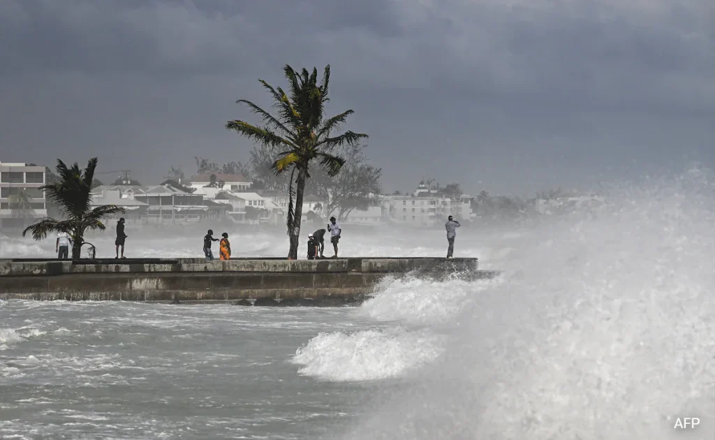
Hurricane Beryl strengthened into a top-level category 5 storm after it swept across several islands in the southeastern Caribbean, dumping heavy rain and unleashing devastating winds.
Beryl is now the earliest category 5 storm in the Atlantic on record and has developed into a “potentially catastrophic” hurricane, the US National Hurricane Center (NHC) said.
The NHC said in its latest update early on Tuesday that Beryl was “still intensifying,” with recent data showing maximum sustained winds had increased to almost 165 miles (265 kilometres) per hour.
Grenada’s Carriacou Island took a direct hit from the storm’s “extremely dangerous eyewall” early Monday, the NHC said.
Nearby islands, including St Vincent and the Grenadines, also experienced “catastrophic winds and [a] life-threatening storm surge,” it said.
“In half an hour, Carriacou was flattened,” Dickon Mitchell, Grenada’s prime minister, told a news conference.
“We are not yet out of the woods,” Mr Mitchell said, noting that while no deaths had been reported so far, he could not say for sure that none had occurred.
Video obtained by AFP from St George’s in Grenada showed heavy downpours with trees buffeted by gusts.
Mr Mitchell said later on social media his government was working to get relief supplies to both Carriacou and the island of Petite Martinique on Tuesday.
“The state of emergency is still in effect. Remain indoors,” he wrote on Facebook.
Beryl became the first hurricane of the 2024 Atlantic season on Saturday and quickly gathered strength.
Experts say that such a powerful storm forming this early in the Atlantic hurricane season – which runs from early June to late November – is extremely rare.
It is the first hurricane since NHC records began to reach the Category 4 level in June, and the earliest to reach Category 5 in July.
“Only five major (Category 3+) hurricanes have been recorded in the Atlantic before the first week of July,” hurricane expert Michael Lowry posted on Twitter.
Barbados appeared to be spared the worst of the storm but was still hit with high winds and heavy rain, although officials reported no injuries so far.
Barbados seems to have “dodged a bullet,” Wilfred Abrahams, its minister of home affairs and information. said in an online video, but nonetheless “gusts are still coming, the storm-force winds are still coming”.
Homes and businesses were flooded in some areas and fishing boats were damaged in the capital, Bridgetown.
The storm prompted the cancellation of classes on Monday in several of the islands, while a meeting this week in Grenada of the Caribbean Community and Common Market (CARICOM) was postponed.
Jamaica has issued a hurricane warning ahead of the storm’s expected arrival on Wednesday, with the NHC forecasting it would bring “life-threatening winds and storm surge”.
A tropical storm warning was also issued for the south coast of the Dominican Republic, where authorities placed two provinces on red alert.
The NHC warned the Cayman Islands and areas on the Yucatan Peninsula to monitor the storm’s progress.
A Category 3 or higher on the Saffir-Simpson scale is considered a major hurricane.
The US National Oceanic and Atmospheric Administration said in late May that it expects this year to be an “extraordinary” hurricane season, with up to seven storms of Category 3 or higher.
The agency cited warm Atlantic Ocean temperatures and conditions related to the weather phenomenon La Nina in the Pacific for the expected increase in storms.
Extreme weather events including hurricanes have become more frequent and more devastating in recent years as a result of climate change.
